
Fishing guide
Best tides for fall and winter striped bass fishing, New Jersey to North Carolina
How to time the fall striper run with the tide from New Jersey to North Carolina: moving water, inlets vs. open beach, dawn and dusk tide changes in the next 30 days, and where to check each state's rules.
The short version: fish the moving water, not the slack. Around inlets that usually means the hours between the tide changes, when the current runs hardest. On open beaches it means the stretch of tide that puts water over your bar, hole or rip. In fall and early winter, the best odds come when a good stage of tide lines up with first or last light. The table below lists the next dates when a tide change falls within an hour of sunrise or sunset at 24 surf beaches from Sandy Hook to Hatteras.
Every fall, striped bass that spent the summer from New York to New England move back down the coast. The Atlantic States Marine Fisheries Commission (ASMFC) puts it simply: in the ocean, striped bass "tend to move north during the summer and south during the winter," and "important wintering grounds for the mixed stocks are located from offshore New Jersey to North Carolina" (ASMFC: Atlantic striped bass). That migration is the fall run that surf anglers on the Jersey Shore, the Delmarva beaches and the Outer Banks wait for. This guide is about timing it with the tide. For the basics, start with best tide for surf fishing.
1. Moving water beats slack water
Current moves bait, and stripers are built to hold in it and ambush what it carries. That's why so much striper advice comes back to current. NOAA explains that in coastal rivers and estuaries the current goes briefly slack, "generally" around high or low tide, and then switches direction and builds again (NOAA: tidal currents). In practice:
- Inlets, jetties and bridges: the middle hours of the outgoing tide pull bait out of the bays and are a classic striper window, and the incoming can be just as good on the inside. Slack water is often the quiet time. In some inlets the turn of the current comes well after the high or low, so if your spot has a NOAA current station, check its current predictions too.
- Open beaches: what matters is the water over the structure. Many sloughs and cuts fish best from the last couple of hours of the rising tide into the first part of the falling tide, when there is enough depth for fish to move in. Scout at low tide and you'll see where the holes and cuts are.
- Spring vs. neap: around the new and full moons the tide range is bigger and currents run harder. This fall and winter, each full moon falls near perigee, so those weeks will move the most water. See king tides 2026–2027 for the exact dates.
2. Low light helps
Surf anglers have long found that stripers feed best in low light, so dawn, dusk and night are the classic surf times, especially in clear water and on calm days. When a good stage of tide lands in that window, you get both on your side. In November and December the days are short, so first and last light are easy to fish around work.
The table shows the days in the next 30 days when a high or low tide falls within an hour of sunrise or sunset at each beach. A tide change at dawn means the strong current of the next tide arrives in the morning. Tap a beach to see its "Best fishing times" for today, which combine the tide, sunrise and sunset and the moon into one 1-to-10 rating.
| Beach | Days | Next tide changes at first or last light |
|---|---|---|
| Sandy Hook, NJNOAA Sandy Hook, Fort Hancock | 18 |
|
| Long Branch, NJNOAA Long Branch (Fishing Pier) | 20 |
|
| Belmar, NJNOAA Belmar, Atlantic Ocean | 20 |
|
| Point Pleasant Beach, NJNOAA Manasquan Inlet, USCG Station | 19 |
|
| Seaside Heights, NJNOAA Seaside Heights, Ocean | 20 |
|
| Barnegat Light, NJNOAA Barnegat Inlet, USCG Station | 20 |
|
| Long Beach Island, NJNOAA Beach Haven Crest | 22 |
|
| Brigantine, NJNOAA Atlantic City (Ocean) | 18 |
|
| Atlantic City, NJNOAA Atlantic City (Ocean) | 18 |
|
| Ocean City, NJNOAA Longport (Inside), Great Egg Harbor Inlet | 19 |
|
| Sea Isle City, NJNOAA Ocean Drive Bridge | 18 |
|
| Wildwood, NJNOAA Wildwood Crest, Ocean Pier | 19 |
|
| Cape May, NJNOAA Cape May, Atlantic Ocean | 19 |
|
| Lewes, DENOAA Lewes (Breakwater Harbor) | 20 |
|
| Rehoboth Beach, DENOAA Rehoboth Beach | 19 |
|
| Bethany Beach, DENOAA Indian River Inlet (Coast Guard Station) | 19 |
|
| Ocean City, MDNOAA Ocean City (Fishing Pier) | 19 |
|
| Chincoteague, VANOAA Chincoteague Island, USCG Station | 20 |
|
| Virginia Beach, VANOAA Virginia Beach | 19 |
|
| Duck, NCNOAA Duck Pier | 19 |
|
| Nags Head, NCNOAA Jennettes Pier, Nags Head (Ocean) | 19 |
|
| Rodanthe, NCNOAA Oregon Inlet (USCG Station) | 20 |
|
| Buxton, NCNOAA Cape Hatteras Fishing Pier | 18 |
|
| Hatteras, NCNOAA Hatteras (Ocean) | 21 |
|
Because the tide arrives about 50 minutes later each day, a run of good dawn tides usually lasts a few days. It comes back about two weeks later. The dates move from beach to beach, so check yours. Inlet stations lag the ocean beaches, and back-bay stations lag even more (see the ocean vs. inlet vs. bay comparisons in our Jersey Shore and Outer Banks guides).
3. Follow the run south
The fall run doesn't arrive everywhere at once. It generally builds on the northern Jersey Shore first and moves south through Delmarva toward Virginia and North Carolina as the water cools. Local tackle shops and state fishing reports are the best guide to where fish are right now.
4. Know the rules before you go
Striped bass are managed coastwide by ASMFC and rebuilding is under way, so the rules are strict. Under ASMFC's current plan, the ocean recreational fishery has a one-fish bag limit and a 28-inch to 31-inch slot, and anglers fishing with bait must use circle hooks (ASMFC). Fishing for striped bass is prohibited in federal waters, more than 3 miles from shore. States set their own seasons, inland and bay rules and license requirements, and they can change during the year, so check the official source for where you're fishing:
- New Jersey: NJ Fish & Wildlife marine fishing regulations (free NJ Saltwater Recreational Registry required).
- Delaware: DNREC Division of Fish & Wildlife.
- Maryland (Atlantic coast and coastal bays): Maryland DNR Fishing and Boating Services. Chesapeake Bay rules are different.
- Virginia: Virginia Marine Resources Commission. Coastal and Chesapeake Bay rules are different.
- North Carolina: NC Division of Marine Fisheries (coastal fishing license required). Inside waters have their own rules and closures.
Handle fish you release with care. ASMFC estimates that about 9% of striped bass released by recreational anglers die afterward, so quick releases, wet hands and keeping big fish in the water all help.
Tide charts for striper beaches
New Jersey: Sandy Hook, NJ, Long Branch, NJ, Belmar, NJ, Point Pleasant Beach, NJ, Seaside Heights, NJ, Barnegat Light, NJ, Long Beach Island, NJ, Atlantic City, NJ, Ocean City, NJ, Cape May, NJ. Delaware and Maryland: Lewes, DE, Rehoboth Beach, DE, Bethany Beach, DE, Ocean City, MD. Virginia: Chincoteague, VA, Virginia Beach, VA. North Carolina: Duck, NC, Nags Head, NC, Rodanthe, NC, Buxton, NC, Hatteras, NC. Inlet stations: Manasquan Inlet, USCG Station, NJ, Barnegat Inlet, USCG Station, NJ, Oregon Inlet Marina, NC.
FAQ
What is the best tide for striped bass?
Moving water. Around inlets and jetties the middle hours of the tide, when the current runs hardest, are usually best, and slack water is often slow. On open beaches the best stage depends on the structure: many sloughs and cuts fish best from the late rising tide into the early falling tide. Scout your beach at low tide to learn where the fish will be.
Is incoming or outgoing tide better for stripers?
Both can be good. The outgoing tide is a classic around inlets because it pulls bait out of the bays, while the incoming often fishes well on open beaches and inside the inlets. The bigger factor is whether the water is moving and whether it lines up with low light.
When is the fall striper run in New Jersey and North Carolina?
It varies with water temperature and bait. ASMFC says ocean striped bass move south in winter and have important wintering grounds from offshore New Jersey to North Carolina. The run generally reaches the northern Jersey Shore first and works south toward Virginia and North Carolina later in the season. Check local fishing reports for current conditions.
What size striped bass can I keep?
Under the ASMFC plan, the ocean recreational limit is one fish in a 28-inch to 31-inch slot, and striped bass fishing is closed in federal waters beyond 3 miles. State seasons and inside-water rules vary and can change, so check your state's official regulations before you keep a fish.
Do stripers bite better at dawn and dusk?
Low light is a classic striper time, especially in clear water and on calm days. When a tide change or good tide stage falls near sunrise or sunset, many anglers make a point of being on the beach. The table on this page lists those days for 24 beaches.
Sources
- ASMFC: Atlantic striped bass (migration, management, current ocean recreational measures, release mortality).
- NOAA Ocean Service: tidal currents.
- Tide predictions: NOAA CO-OPS (public domain). Sunrise and sunset: NOAA solar calculator equations.
- State regulations: NJ Fish & Wildlife, Delaware DNREC, Maryland DNR, Virginia Marine Resources Commission, NC Division of Marine Fisheries (links above).
Gear for Best tides for fall and winter striped bass fishing, New Jersey to North Carolina
Affiliate linksSurf fishing and beach gear often used here — search links, not a ranked list.
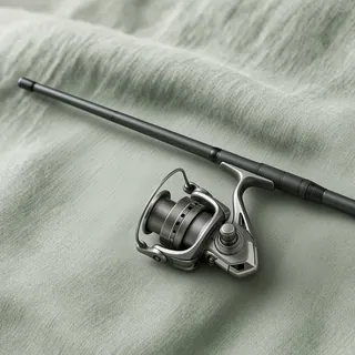 Surf fishing rodon Amazon →
 Saltwater tackle boxon Amazon →
 Crab trapon Amazon →
 Beach carton Amazon →
 Polarized sunglasseson Amazon →
 Tide clockon Amazon →
As an Amazon Associate, TideCharts USA earns from qualifying purchases. How this works
More tide guides
- Best tide for surf fishing: high vs. low, incoming vs. outgoingWhy moving water matters, how beach shape changes the answer, and notes for stripers and fluke.
- Jersey Shore surf fishing by tideOcean vs. inlet vs. back-bay tide timing, the free NJ registry, and every shore town's tide page.
- Outer Banks surf fishing and tidesOcean vs. sound tides, pier stations, the NC license and Cape Hatteras ORV permits.
- King tides 2026–2027: dates and times by beachThe highest predicted tides from November to February, beach by beach, with times and heights.
- How to read a tide chartTimes, heights, MLLW, rising vs. falling water and which station to trust, with a live example.